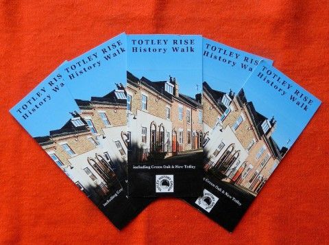
Totley Rise History Walk


This leaflet is available in PDF format for home printing and is an Adobe Acrobat document [1.3 MB].

Totley Rise History Walk (Version 4. Revised 5 August 2014)

Totley Rise Walk map


This is a walk around New Totley, Green Oak and that part of Totley Rise that lies within the traditional boundaries of Totley township. The walk starts and ends at Totley Library, 205 Baslow Road, S17 4DT, about 6 miles southwest of Sheffield on the A621 and a stopping point on bus route 97 from the city centre.


1. Totley Library Baslow Road, south side

Totley Library moved here in 1964 from the building next to Tesco Express, Baslow Road (in Dore) which had been converted from an electricity showroom and offices in 1939. The new library was built on land that had been owned by George Pearson & Sons, nurserymen and market gardeners, who constructed two large glasshouses for their business which became known as Heatherfield Nurseries.


Follow the footpath away from Baslow Road down to Lemont Road, turn left and cross the road. After passing Mona Villas, enter the park. 


2. Green Oak Recreation Ground off Lemont Road, south side

The Recreation Ground was opened by Mrs Sarah Milner, of Totley Hall, on 23 March 1929 on two pieces of land sold to Norton Rural District Council by John Thomas Carr, a retired farmer and butcher, for the sum of £1,550. The sale also included a small plot of land and buildings on the south side of Lemont Road for access. To the west was Pearsons' nursery and to the south and east Colin Thompson's farm land. The bowling green was constructed in 1956 and opened the following year.


Leave by the small gate at the opposite end of the park, beyond the children's playground. Bear right through the cul-de-sac on to Green Oak Avenue. Turn left and walk a short distance down to the cross roads of Green Oak Road and Aldam Way.


3. The Last Prefabs (site of) Green Oak Road, south side

Prefabs (prefabricated bungalows) were a quick-fix remedy for housing shortages between and after the two World Wars.  The Totley prefabs were probably of an American design and, as these structures went, were of a high standard, particularly the fittings, bathrooms and floors. Built mainly during 1945, they were neatly laid out on paths and covered much of the area that is now the upper part of Green Oak Road, Green Oak Avenue and Aldam Way. They were never intended to last as long as they did - the last prefabs being demolished in the early 1970s. 


Turn left down Green Oak Road and second right into Aldam Road. Cross the road and after a short distance turn left at the public footpath sign. Ignoring the main path to your right which leads towards Gillfield Wood, carry on past the Scout Hut, across a small wooden footbridge over the Totley Brook and up a short but steep bank on to the lane. Turn right and walk a short distance to the next farm gate on your left at the top of the rise.


4. Woodthorpe Hall Drive & St. George's Farm off Mickley Lane, west side

The lane up to Woodthorpe Hall has been known by various names including White(s) Drive or Lane. There is a view across the field to the rear of the farm which is just over the Totley boundary into Dronfield (see inset). The 13 acre farm was referred to by a variety of names before it was bought by the Guild of St George in 1877. The Guild had been established in 1871 by the artist, writer and social thinker John Ruskin who had a Utopian vision of creating a place of beauty and peace, working the land as a model orchard and botanical garden without modern machinery whilst encouraging traditional crafts. The land was first used as allotments and later as a land colony but by 1880 the venture had foundered. The farm was taken over at first by Ruskin's own head gardener whose attempts to grow strawberries, currents and gooseberries also failed. In 1889 George Pearson took over the farm at first as a tenant. In the 1920s, when the Guild was divesting itself of its smaller holdings, Pearson was offered and bought the farm outright. The family business has flourished ever since.


Retrace your steps along the lane and turn right over the stile before the allotments and up the path to the exit via the car park at the top of the field.


5. Mickley Hall Mickley Lane, east side

Mickley Hall, as it is now called, was purpose-built in 1867-68 for the Cherrytree Orphanage which had been founded in Sheffield by the Rev. Edward Ridge Taylor, a former army chaplain, three years before Dr. Barnado formed his home in London. So great was the demand for places that the Orphanage moved to larger premises firstly in Highfield and then in Totley. In April 1868, the property was transferred to a board of 22 trustees which included George Bassett and Thomas Cole (Cole Brothers) as an institution to receive poor children whose parents had died in order to receive board, clothing, education and religious instruction. Children were given the chance to learn a trade and introduced to new homes.


Approval was given by the trustees in October 1964 to sell the Cherrytree buildings to the Cheshire Foundation, a disability charity named after Group Captain Leonard Cheshire, for £12,000 plus £500 towards the cost of roads, if needed. In 1967 the Sheffield Cheshire Home was formally opened by Her Grace, the Duchess of Devonshire in the building vacated by Cherrytree Childrens Homes. It is Grade II listed.


Descend Mickley Lane on the footpath, taking care as there are some blind corners.

6. Brook Hall Mickley Lane, east side

Brook Hall was built in the early 19th century for Joseph Ward, coal merchant, and bought by Cherrytree Orphanage in 1867 for use on a temporary basis until the larger building on adjacent land could be built. It is now a Grade II listed building. The Coach House and Stable to the rear were built in the same period and are separately listed Grade II. 


7. Brook Hall Lodge Mickley Lane, east side

Cherry Tree Lodge as it is now called was built circa 1850 as the lodge to Brook Hall. It is also Grade II listed.


8. Totley Lane Mickley Lane, east side

This old trackway climbs steeply uphill towards Hall Farm and Tinker's Corner in Lower Bradway. Only the very bottom section, below the original course of the Lumb Brook, is in Totley. The brook has been diverted from joining the Totley Brook at the bottom of Queen Victoria Road via a culvert under Mickley Lane.


9. Shepley Spitfire Mickley Lane, west side

The pub was built in 1979 by Hardys & Hansons Brewery of Nottingham. It is named after Pilot Officer Douglas Shepley of Woodthorpe Hall who died in 1940 when his plane was shot down and whose family raised funds to buy a new aircraft. Whilst the Spitfire weather vane remains, the splendid pub sign which incorporated a photo of Douglas has recently been mounted on the wall near the steps up to the entrance.


10. Brook Terrace (site of) Mickley Lane, east side

Brook Terrace (numbers 79-85 Mickley Lane) was built around 1888 on the other side of the road, between Glover Road and the Totley Brook. Harry Brearley (1871-1948), the inventor of stainless steel, moved into the end house nearest Glover Road in 1895. He was still living there at the time of the census six years later but by 1910 he had moved to Old Whittington, Chesterfield. The terrace was demolished around 1956.


Turn right into Laverdene Avenue.


11. Old Ford & The Chemical Yard (site of) off Laverdene Avenue, east side

Back Lane used to run from Bricky Row across a ford over Totley Brook to an upper section leading up to Queen Victoria Road. The footbridge is close to where the old ford was and the cobbles can still be seen when water levels are low. On the Bradway side was the Chemical Yard where Tinker & Siddall first manufactured chemicals in the 1840s. By 1857 Tinker & Co had extensive chemical works there and by 1889 Thomas Kilner was manufacturing pyroliginous acid, naptha and charcoal. The area was later used for various purposes including a blacksmiths, the Brookvale Laundry and C J Marcroft's builders yard.


Continue along Laverdene Avenue which bends to the right, cross to the left of the road and then follow the footpath to the left of the high wall. Turn left at Glen Rose, up the hill to the corner of Back Lane and Glover Road. Walk down the lay-by in front of the shops.


12. Bricky Row Baslow Road, southeast side

Very little has been written about the early years of the Totley Rise shopping crescent (15-71 Baslow Road) beyond that it was originally a row of houses built circa 1888 to provide accommodation for the navvies who built the Totley Tunnel. New research suggests, however, that the houses may not have been built all at the same time and that most of the row was in existence before 1881. Whilst a few shops date from around 1888, such as Colin Thompson's butchers, the conversion of the upper part of the terrace to shops and businesses came later. The top section of the row was owned by a brewery and it was intended to build a hotel on the corner by Back Lane. When an application for a drinks licence was declined, the property was subdivided and converted into shops. More research is needed.


13. Rolling Mill Pond (site of) Mill Dale Road

The Rolling Mill pond was at the back of Bricky Row, where the extension to Laverdene Avenue is now, widening out at the bottom of the Rise and taking in most of what is now Mill Dale Road. The mill was fed by the Totley Brook but, in addition, there was a massive stone weir near the present Methodist Church which diverted the Oldhay Brook into the pond when necessary. The weir was dismantled in 1933, the dam wall having been removed in 1920. It is said that the stone was taken to Millhouses and re-used to build a tea-room extension to the Waggon & Horses.


Continue down Baslow Road and turn right at path in front of the small triangular green into Mill Lane.


14. Rolling Mill Cottages Mill Lane, west side

There was a complex of buildings at the northern end of the mill pond including these terraced cottages which were built for the mill workers and the cottage on the other side of Mill Lane which was the mill manager's house. It is not known when the first mill was built but in 1615 the Gill family had a lead smelting mill here. By 1750 part of the mill was converted to a grinding wheel and by 1780 a lead rolling mill was in operation. In 1836 John Dyson bought the mill for steel-rolling. He had a grinding wheel, 4 troughs, smelting furnace, brickyard, kiln and blacksmiths shop here as well as gardens, a wood and the dam. By 1872 William Tyzack & Sons were operating as steel rollers and they also made scythes and sickles here. Ebenezer Hall, of Abbeydale Hall, bought the mill in 1881 and production ceased a few years later. 


Continue to the end of Mill Lane and on to a very narrow footpath between the high garden fences of Poynton Water on your left and Mill Cottage on your right towards a small footbridge.


15. Source of the River Sheaf off Mill Lane, west side

The footbridge at the end of Mill Lane crosses the Totley Brook close to its confluence with the Oldhay Brook to form the River Sheaf.  Barely visible now that a high fence has been constructed, admittedly, but in the picture we can see three parishes: Totley is on the front left, Bradway on the front right and Dore at the back, where the Electricity Station stands.


Now retrace your steps up Mill Lane and turn right in front of the triangular green and cross Baslow Road at the crossing point opposite Grove Road. Turn left past the Totley Rise Methodist Church.


16. Boundary Bridge Milestone Baslow Road, west side

The road sign would have you believe that you enter Totley at the railway bridge, but the traditional boundary is the bridge over the Oldhay Brook.  The inscription on the north wall reads "Bakewell 15 Miles - Parish of Totley - Parish of Dore - Sheffield 5 Miles".  The Totley Rise Methodist Church is in Dore, of course.


Continue up the hill and re-cross Baslow Road at the traffic lights. Turn right past the Vets and continue up to the last of the large houses.

17. The Queen's Temperance Hotel & Victoria Gardens (site of) Baslow Road, south side

Numbers 85 (the dental practice) and 87 Baslow Road were once one establishment that has been used as a hotel and gentlemen's club. It was called the Queen's Temperance Hotel in 1891, the Abbeydale Club in 1900 and later the King's Arms Hotel. The single-storey extension by the side of number 87, refurbished in the 1990s, was used as a hotel bar.


Behind this building the Victoria Gardens stretched as far as Mickley Lane and the Totley Brook. Victoria Gardens was opened on Whit Monday in 1883 by Alderman Joseph Mountain to rival Belle Vue in Manchester. It had a ballroom, refreshments room, menagerie, sports grounds and even a boating lake. Although very popular at first by 1887 it had failed. This is usually attributed to its inability to obtain a drinks licence. Shortly after it closed, the pavilion was used for a few months as a smallpox convalescent unit. The gardens reopened during the building of the Totley Tunnel before finally closing in 1894.


Turn left at the blocked off road (Laverdene Road) and down to the junction with Mickley Lane. Cross the road and turn right to the next corner.

18. Lemont Road 

When they were built, the fine terraced houses on Lemont Road would have been surrounded by fields and uninterrupted views up to Baslow Road and down to the Totley Brook. Hawthorn Cottages on the corner of Mickley Lane are dated 1876, although Lemont Road was not shown in the survey map of that year. The area was then known as Green Oak; the first use of the name Lemont appears to be in about 1907.


Proceed up Mickley Lane to the grass verge at the corner with Baslow Road.


19. St John's Church Parish Boundary Baslow Road, south side

The stone at the junction of Mickley Lane and Baslow Road marks the western boundary of the Parish of St John the Evangelist, Abbeydale.  It is inscribed "St. JC 1877 No.2"


Cross to the opposite side of Baslow Road.


20. Greenoak Inn Baslow Road, north side

The Greenoak Inn was built in 1812 to take advantage of the new turnpike which came up Mickley Lane and on through Owler Bar to Stoney Middleton. Shortly afterwards the turnpike road to Sheffield via Abbeydale was built. A toll bar stood higher up Baslow Road before what is now the Roman Catholic Church. Like the Cross Scythes, the publicans were also farmers. The inn is thought to have been closed about 1850 and the property became a family residence set in its own grounds. The oldest part is in the middle of the block where the two shops are. It was extended to the right (Rosies) when it became a house and to the left in the 20th century.  


Walk a short distance up Baslow Road and turn the corner into The Crescent.


21. Church of the English Martyrs Baslow Road, north side

Built in 1964, the Church of the English Martyrs is the first Roman Catholic Church in Totley. Before that, services were held in a room in The Cross Scythes Hotel. There used to be an old well pump dating back to at least 1896 which stood close to the wall near the bus stop until it was demolished in a traffic accident.


Go straight across the next crossroads to the end of Terrey Road and turn right at the large monkey puzzle tree into The Quadrant. On the left, behind the second of two large square shrubs is a narrow entrance to a public footpath whose sign is often obscured . 


22. Akley Bank off The Quadrant, north side

Akley means 'Oak Clearing' and records of an oak wood hereabouts go back at least as far as 1561. The path is over 700 years old; it went from Beauchief Abbey to sheep pastures at Strawberry Lea. In the 16th century the wood was used by the 6th Earl of Shrewsbury to fuel his lead mill further upstream at Old Hay. 


From Akley Bank retrace your footsteps as far as the first crossroads. Turn right into The Quadrant which soon becomes The Grove and left into and through the The Green back to Baslow Road. Turn right. 


23. Totley Grange (site of) Baslow Road, north side

Totley Grange was built in 1875 on land bought by Ebenezer Hall. From 1891 it was lived in by Thomas Earnshaw, a fish and game dealer from Sheffield and became known as 'Fish Villa'.  During World War II it was used as a production depot of J G Graves Ltd Wireless Factory making the wiring for a variety of aircraft including Wellington and Lancaster bombers. The Grange was demolished in 1965 making way for the estate built by Wimpeys. What remains are a few high walls, the summer house at the rear of a house on Totley Grange Road and this gatepier which stood close to the main drive and lodge.


Return to the Library down Baslow Road.


A section of the walk alongside the Oldhay Brook beneath Akley Bank has had to be omitted as access to this private land belonging to the owner of Totley Grove has been recently withdrawn after at least 100 years of free access. Two of Totley's most famous Victorian structures are no longer available to visit.


Brick Aqueduct off Grove Road, south side

When they were building the section of railway line between Totley Tunnel and the Baslow Road bridge, the engineers had to divert the Oldhay Brook below Totley Grove across this fine curved brick viaduct to a straightened and canalised section on the south side of the track before rejoining its original course near the footbridge at the base of Akley Bank.


Totley Tunnel East Portal off Grove Road, south side

By climbing the wall of the brick viaduct (or more easily by holding a camera above the parapet) you can get a glimpse of the eastern portal of the Totley Tunnel, 6230 yards long, opened for freight in 1893 and passengers the following year. It was built by Thomas Oliver & Sons, of Horsham, for the Midland Railway Company and at the time was the second longest railway tunnel in the country, exceeded only by the Severn Tunnel.